Historic maps of the Braydon Forest
Which took place on Sunday 6th September at Sundey Hill Farm. We were joined by experts including Ian Christie, George Monck and Tim Bonner and Frances Ward.
Character Description
Source: Wiltshire County Council (2005)
The Minety Rolling Clay Lowland lies to the north of the county largely surrounded by other low lying land including areas of Open Clay Vale to north and south. The Minety Rolling Clay Lowland is more wooded and sparsely settled than the others in the type, showing the strong influence of its historic land use as part of the Royal Hunting Forest of Braydon. Substantial blocks of woodland dominate the central part of the area, including some where traditional maintenance methods are still in place as at Ravensroost Wood SSSI and a remnant of wood pasture at Somerford Common. Fields are medium to large, mainly pastoral with a strong hedgerow network in good condition with many mature oak hedgerow trees. The central area is crossed by straight minor roads with sparse dwellings scattered along them and at crossroads. To east and west the pattern is more like the rest of the type with small nucleated villages such as Cloatley, Minety and Charlton with its historic parkland, linked by winding roads. Buildings tend to be of stone at the west of the area such as at Charlton, with brick and render more frequent to the east reflecting the change from Limestone to Clay geology.
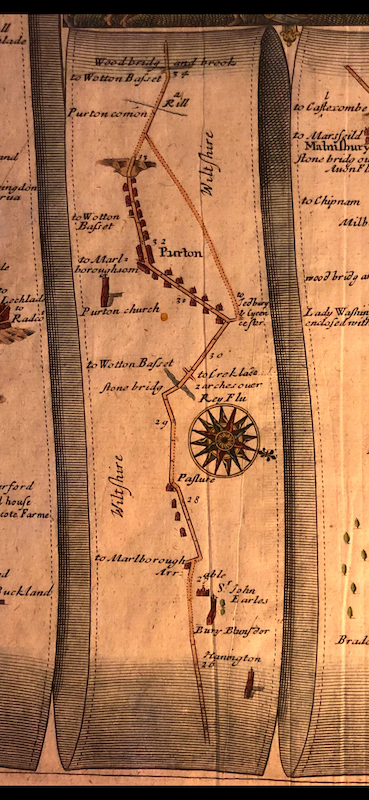
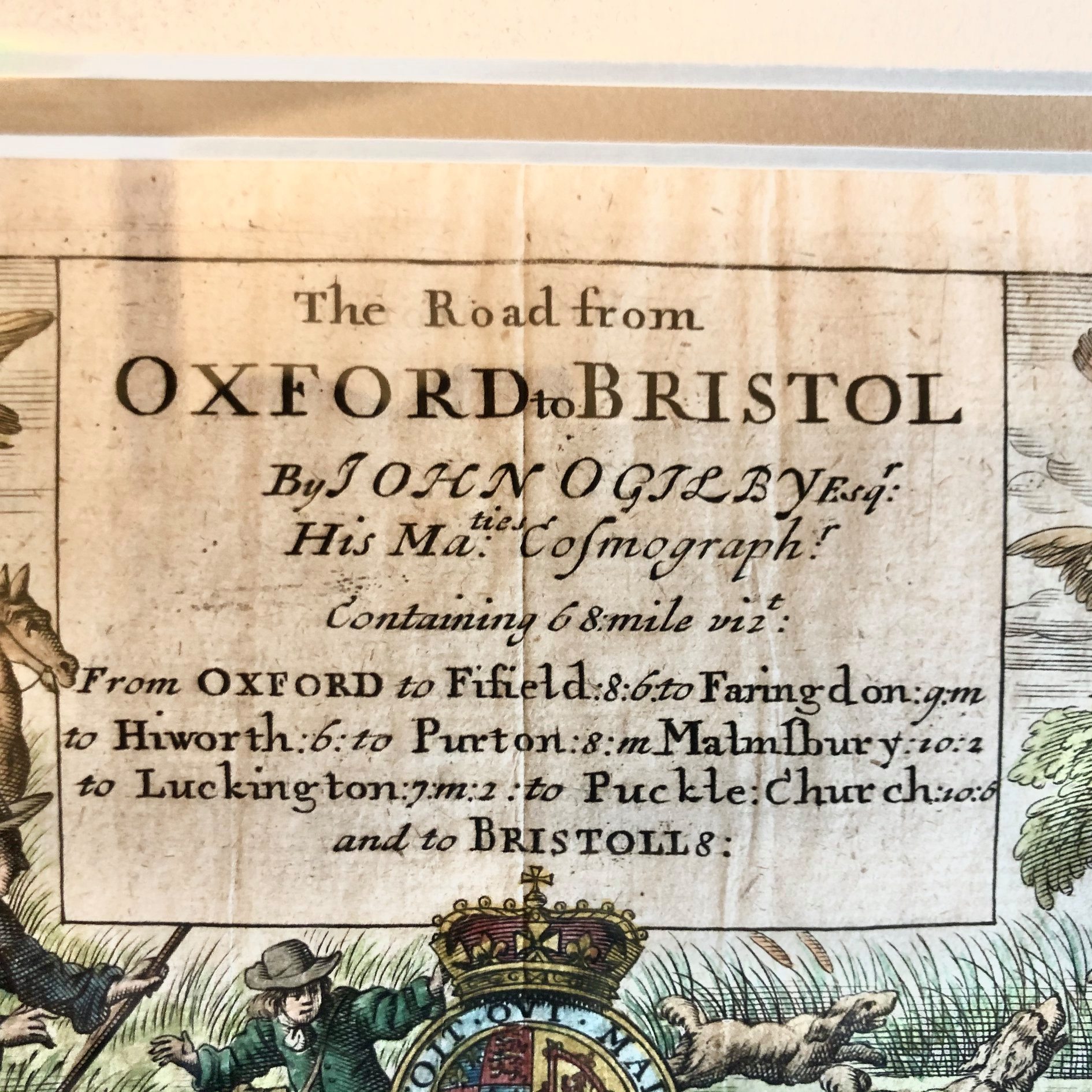
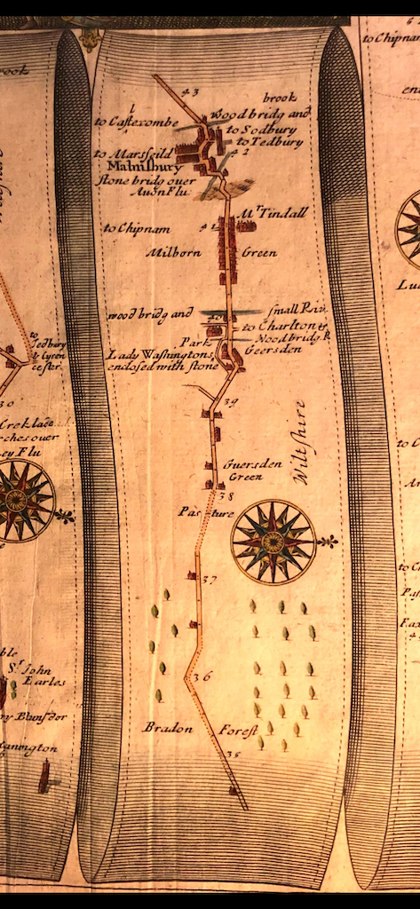
The map sourced with the kind help of David Mitchell. The map was surveyed by John Ogliby in the early 1670s . The first edition was published in 1675, and this version was the second edition, published in 1698.